Julian Bleecker and Will Carter recently released geotagthings, a simple piece of software that allows to assign geographic meta data to arbitrary web resources.
otagthings, a new web service designed to quickly and easily assign any web resource — anything with a URL — a location in the normal, human physical world. Using Yahoo! Maps' interface and API, Geotagthings makes short work out of a previously complicated process, while providing an open feed-based mechanic for retrieving geotagged resources and displaying them in your favorite news aggregator. (description taken from their Where2.0 presentation
How it works?
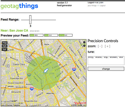
Anything with a URL can be given a latitude/longitude by simply clicking a bookmarklet, picking the spot it should be assigned using a map interface, adding a little note and that's that. The URL and note get shoved into a data store where it can be accessed through an RSS feed. Anyone can get a feed for a locale simply by going to the feed generator, picking where you'd like to get a feed from, determining a range around that spot and grabbing the URL from one of the feed badges, and dropping it into your favorite news aggregator, like NetNewsWire.
Registration can be done here
Why do I blog this? because I think it's an interesting service; the why question behind that is pertinent: they ask "why" in their description and answerrfs "the network needs geographic semantics to make data resources relevant to meaningful, useful location-nased services".