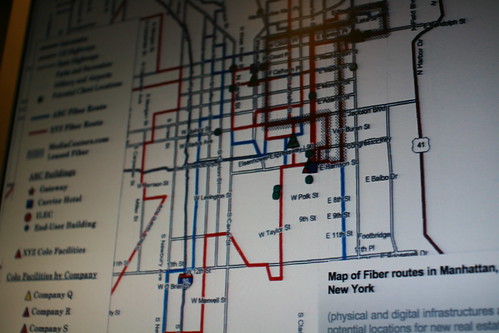
 (Maps of optic fiber routes in an urban environment taken from Jef Huang's talk at the world congress of architecture)
Meanwhile, on the urban computing front, Adobe Think Tank featured an insightful article by Karzys Varnelis and Leah Meisterlin entitled "The invisible city: Design in the age of intelligent maps". It described how today's maps are not just about spatial relationships but rather about revealing invisible information ("previously hidden in spreadsheets and databases") through new sorts of representation.
As the authors say, maps are now so ubiquitous that they're a key component of network culture: we use map on the web, on mobile, in car GPS, etc. and even on the street.
Concerning the implications:
"...is not just a new representation of the city that emerges out of this data; its a new hybrid city, part physical texture and part data-driven map. (...) For designers, the implications are clear. As maps become richer, more complicated, and less predictable, cartography becomes less a matter of convention and more a matter of invention. Our age of intelligent maps demands intelligent map design (...) Instead of seeing ourselves as part of the city fabric, inhabiting a three-dimensional urban condition, we dwell in a permanent out-of-body experience, displaced from our own locations, seeing ourselves as moving dots or pins on a map. In doing so, we experience ourselves less as individuals and more as data moving along a planetary network, composed of both telematic circuits and the physical pathways of the global city. (...) [and also some critical perspectives:] If ubiquitous mapping systems are a powerful new tool, uncritical reliance on them can easily lead users astray. (...) it is also disappointing—and perhaps indicative of where Google is ultimately going in all this—to observe that layers of content for ubiquitous mapping applications remain so tied to traditional datasets"
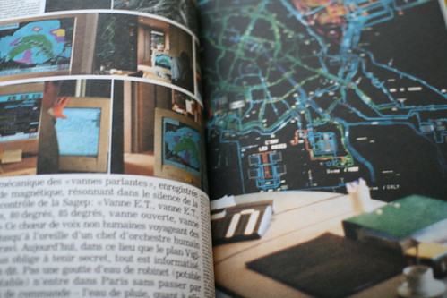 (Picture of the book "Paris ville invisible" by Bruno Latour which deals with this issue)
So what can be done? how to design meaningful interactions and using alternative datasets? Varnelis an Meisterlin describe how "interventionist mapping" has started to gain some interest recently, mentionning examples like Stamen's INdigital Wireless E9-1-1 or Justice Mapping Center and Columbia University's Spatial Information Design Lab's series of maps depicting the Million Dollar Blocks. These projects, by showing relationships and patterns can become more than expository: they allow to ask questions, draw conclusions and help to mobilize people politically.
And while maps's role evolve, so does our relationship to the spatial environment
"In the past, maps existed as much to mark out the unknown, to slowly fill in areas blank except perhaps for the legend "here be monsters," as to represent the known territory of the city. Today, however, with polar exploration, mountain climbing, and even space travel, becoming increasingly banal amusements instead of feats of daring exploration, maps are shifting toward a new relationship between the known and the unknown. (...) maps as navigational tools for the physical traversal of space are supplanted by intelligent maps for navigating a contemporary space in which the physical becomes a layer of data in a global informational space (...) Much of this world is invisible and it is the task of the designer to help us understand it."
Why do I blog this? Accumulating material for a near future laboratory pamphlet about urbain comuting. The article reads as an interesting follow-up to Urban Computing and Its discontent by Adam Greenfield and Mark Shepard, since it looks at the same boundary object through another perspective.
Perusing this also made me think about what Dan Hill recently described about his position at Arup (and some examples of what is of interest to him):
"I'm currently exploring a few ideas in particular, such as extrapolating and aggregating Building Information Modelling (BIM) techniques up to the city level - to form a kind of 'City Information Modelling' (CIM). Taken with the feedback from urban informatics, this could then extend the design process out over the true life-cycle of the project, including inhabited and adapted, which would mean a four-dimensional modelling process taking into account the living city, or a '4D Urbanism'. You'll note these concepts are still a bit slippery, to say the least."