Urban

think before you tag

think before your tag First comment, it can be understood as "tag" in the graffiti sense but also in the geotag meaning (i.e. linking content such as text/music/pictures to geographical data). Although it's not a common practice in cities, it's intriguing to see such warning from a possible near future. I'm not sure geotagging will spread but I find pertinent to see how creating such warning include that technology-mediated practice in a sort of "design fiction" narrative: it actually reveals the possibilities and let people (who understands it), wonder about what can be the proper usage.

Second comment, as Timo would say: "it's also serif font on a black background".

Location-based annotation

Red brick An intriguing example of location-based annotation. This red brick inserted in the pavement on Rue de la République in Lyon (France) indicates that former french president Sadi Carnot had been assassinated here on June 25th, 1894. The sort of things that people want to replicate online, but it generally lacks the elegance of the "brick" as en urban element well inserted into its context.

The city, being measured

The city being measured Some measurement devices, capturing and collecting data about the urban environment (paris above, geneva below).

Urban computing measurement device

The sort of stuff which allows some people to design mash-ups, chronotopic representations and visualizations.

"Designed by an engineer"

The city of Lausanne is very proud to have the first swiss subway system (opening very soon). After two years of constructions, some new urban elements are appearing and it's funny to see the pride of the persons who took care of that. See for example this stunning sticker that is pervasive around the new subway entrance: "Designed by an engineer"

It basically says "Conceived/designed by an engineer", I wonder about the background decisions that led to this sticker campaign and find it utterly fascinating. Also what will be people's reaction? Does that make you more confident before taking that elevator?

Of course, I am always thinking how OTHER stickers (such as "Designed by a crocodile wrangler" or "Built by a chicken sexer") would do.

The complexity of GPS accuracy

GPS located on the right Writing a chapter about geolocation history, I am digging the issue of GPS accuracy as it is often a "pain points" in the user (driver) experience. The Road Measurement Data Acquisition System has an interesting paper about it, by Chuck Gilbert.

Gilbert shows how complex the problem of GPS accuracy is and how misleading the advertisements are as they do not convey an intelligible vision of that topic. In general, the admitted accuracy (if there was such thing as admitted accuracy) is between 15 and 100 meters). But what does that range corresponds to? Is it achieve under optimal conditions? under difficult or extreme circumstances? The accuracy values is therefore represented statistically with different means but there is never enough room in an ad to depict this complexity; Gilbert finally recommends not not to use advertisements as an evaluation of GPS accuracy.

The factors that should be listed are the following:

"Required occupation time Type of data recorded (phase or pseudorange) Type of processing (phase or pseudorange) Environmental conditions Maximum allowable PDOP Minimum allowable signal strength Maximum allowable distance between base and rover receivers Horizontal accuracy versus vertical accuracy"

Why do I blog this? although I often focus on the environmental limitations (e.g. narrow streets), the situation is far more complex and it's interesting to pinpoint the different factors that can make a GPS device be inaccurate. How can design take this into account?

Urban pranks

plasticninja (a plastic ninja seen in Rome)

Being a great fan of random acts (and André Gide's acte gratuit), it's always to read what the mainstream press has to say about it. So when the WSJ features something about this, there are sometimes some good excerpts, such as:

"The latest pranksters are "urban alchemists," akin to so-called guerrilla gardeners who cram plantings into sidewalk cracks, or people who create "found art" made from random items plucked from the streets, according to Jonathan Wynn, a sociologist at Smith College in Northampton, Mass.

"These are people in cities who take the public spaces and everyday life and make something kind of magical about it," he says."

Why do I blog this beyond the fun part of prank, they're definitely interesting as signal which reveal the need for meaning making in contemporary cities/societies.

Umbrella hack

Umbrella-ed window An intriguing use of umbrella, seen both in Seoul (above) and Geneva (below). Protect your place with what you have up your sleeve!

Nice hack

Why do I blog this? fascination towards mundane creativity, or how people use what they have to repair stuff, and here it's beyond carboard or duct tape.

"Networked cities" session at LIFT Asia 2008

(Special fav session at LIFT Asia 2008 this morning since this topic is linked to my own research, my quick notes) Adam Greenfield's talk "The Long Here, the Big Now... and other tales of the networked city" was the follow-up of his "The City is Here for You to Use". Adam's approach here was "not technical talk but affective", about what does it feel to live in networked cities and less about technologies that would support it. The central idea of ubicomp: A world in which all the objects and surfaces of everyday life are able to sense, process, receive, display, store, transmit and take physical action upon information. Very common in Korea, it's called "ubiquitous" or just "u-" such as u-Cheonggyecheong or New Songdo. However, this approach is often starting from technology and not human desire.

Adam's more interested in what it really feels like to live your life in such a place or how we can get a truer understanding of how people will experience the ubiquitous city. He claims that that we can begin to get an idea by looking at the ways people use their mobile devices and other contemporary digital artifacts. Hence his job of Design Director at Nokia.

For example: a woman talking in a mobile phone walking around in a mall in Singapore, no longer responding to architecture around her but having a sort of "schizeogographic" walk (as formulated by Mark Shepard). There is hence "no sovereignty of the physical". Same with people in Tokyo or Seoul's metro: physically there but on the phone, they're here physically but their commitment is in the virtual.

(Oakland Crimespotting by Stamen Design)

Adam think that the primarily conditions choice and action in the city are no longer physical but resides in the invisible and intangible overlay of networked information that enfolds it. The potential for this are the following: - The Long here (named in conjunction with Brian Eno and Steward Brand's "Long Now"): layering a persistent and retrievable history of the things that are done and witnessed there over anyplace on Earth that can be specified with machine-readable coordinates. An example of such layering experience on any place on earth is the Oakland Crimespotting map or the practice of geotagging pictures on Flickr. - 
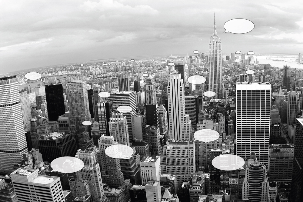
The Big Now: which is about making the total real-time option space of the city a present and tangible reality locally AND, globally, enhancing and deepening our sense of the world’s massive parallelism. For instance, with Twitter one can get the sense of what happens locally in parallel and also globally. You see the world as a parallel ongoing experiment. A more complex example is to use Twitter not only for people but also for objects, see for instance Tom Armitage's Making bridges talk (Tower Bridge can twitter when it is opening and closing, captured through sensors and updated on Twitter). At MIT SENSEeable City, there is also this project called "Talk Exchange" which depicts the connections between countries based on phone calls.

Of course, there are less happy consequences, these tech can be used to exclude, what Adam calls the "The Soft Wall": networked mechanisms intended to actively deny, delay or degrade the free use of space. Defensible space is definitely part of it as Adam points out Steven Flusty's categories to describe how spaces becomes: "stealthy, slippery, crusty, prickly, jittery and foggy". The result is simply differential permissioning without effective recourse: some people have the right to have access to certain places and others don't. When a networked device does that you have less recourse than when it's a human with whom you can argue, talk, fight, etc. Effective recourse is something we take for granted that may disappear.

We'll see profound new patterns of interactions in the city:

  1. Information about cities and patterns of their use, visualized in new ways. But this information can also be made available on mobile devices locally, on demand, and in a way that it can be acted upon.
  2. Transition from passive facade (such as huge urban displays) to addressable, scriptable and queryable surfaces. See for example, the Galleria West by UNStudio and Arup Engineering or Pervasive Times Square (by Matt Worsnick and Evan Allen) which show how it may look like.
  3. A signature interaction style: when information processing dissolving in behavior (simple behavior, no external token of transaction left)

The take away of this presentation is that networked cities will respond to the behavior of its residents and other users, in something like real time, underwriting the transition from browse urbanism to search urbanism. And Adam's final word is that networked cities's future is up to us, that is to say designers, consumers, and citizens.

Jef Huang: "Interactive Cities" then built on Adam's presentation by showing projects. To him, a fundamental design question is "How to fuse digital technologies into our cities to foster better communities?". Jef wants to focus on how digital technology can augment physical architecture to do so. The premise is that the basic technology is really mature or reached a certain stage of maturity: mobile technology, facade tech, LEDs, etc. What is lacking is the was these technologies have been applied in the city. For instance, if you take a walk in any major city, the most obvious appearance of ubiquitous tech are surveillance cameras and media facades (that bombard citizen with ads). You can compare them to physical spam but there's not spam filter, you can either go around it, close your eyes or wear sunglasses. You can compare the situation to the first times of the Web.

When designing the networked cities, the point is to push the city towards the same path: more empowered and more social platforms. Jef's then showed some projects along that line: Listening Walls (Carpenter Center, Cambridge, USA), the now famous Swisshouse physical/virtual wall project, Beijing Newscocoons (National Arts Museum of China, Beijing) which gives digital information, such as news or blogposts a sense of physicality through inflatable cocoons. Jef also showed a project he did for the Madrid's answer to the Olympic bid for 2012: a real time/real scale urban traffic nodes. Another intriguing project is the "Seesaw connectivity", which allows to learn a new language in airport through shared seesaw (one part in an airport and the other in another one).

The bottom line of Jef's talk is that fusing digital technologies into our cities to foster better communities should go beyond media façades and surveillance cams, allow empowerment (from passive to co-creator), enable social, interactive, tactile dimensions. Of course, it leads to some issues such as the status of the architecture (public? private?) and sustainability questions.

The final presentation, by Soo-In Yang, called "Living City", is about the fact that buildings have the capability to talk to one another. The presence of sensor is now disappearing into the woodwork and all kinds of data is transferred instantly and wirelessly—buildings will communicate information about their local conditions to a network of other buildings. His project, is an ecology of facades where individual buildings collect data, share it with others in their "social network" and sometimes take "collective action".

What he showed is a prototype facade that breathes in response to pollution, what he called "a full-scale building skin designed to open and close its gills in response to air quality". The platform allows building to communicate with cities, with organizations, and with individuals about any topic related to data collected by sensors. He explained how this project enabled them to explore air as "public space and building facades as public space".

Yang's work is very interesting as they design proof of concept, they indeed don't want to rely only on virtual renderings and abstract ideas but installed different sensors on buildings in NYC. They could then collect and share the data from each wireless sensor network, allowing any participating building (the Empire State Building and the Van Alen Institute building) to talk to others and take action in response. In a sense they use the "city as a research lab".
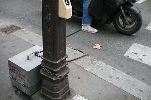
Intentionally slow

Slow mode to take advantage of the view An interesting encounter yesterday at the conference center in Jeju is this sign, which reveal to the user why the elevator is so slow: it has been design for that purpose. Sort of the equivalent of "http://en.wikipedia.org/wiki/Slow_foodslow food" for micro-mobility transportation system.

Why do I blog this? I find this sort of design (and signage) interesting as it shows how transportation systems are more than mere tubes to bring people from A to b as fast as possible. If quantity-management was the paradigm of transportation system in the past, there is now a clear trend towards more qualitative experience/service. That was a topic often addressed by Georges Amar, head of the foresight group at RATP, see for example my notes from one of his talk. Hence the need to slow down sometimes to appreciate landscape (in this case) or also sociability, the passage of time, etc.

City board

Expres yourself on that blank piece of paper Seen in Marseille last week, someone put these blank sheets of paper and ask people to "express themselves". Lowtech and not meant to resist to time but funny. Still bank 2 hours after.

Envisioning the world through the oligopticon

Paris, invisible city Re-reading "Paris: ville invisible" by Bruno Latour, I re-encountered the notion of "oligopticon" that he also defined in his "Thought Experiments in Social Science: from the Social Contract to Virtual Society" (on the 1st of April 1998):

"That is not what sees everything, but what sees a little bit, which is what "Oligos" means in Greek. For instance what is interesting, and we have in our book lots of these examples, is a series of pictures on the Meteo, the French Meteorological Organisation around Paris. Now what is amusing is that what we see from the office here is not the weather. We see just a little bit of the weather, much less than what we see when we look at the map, which is published and printed by the machine; a little more when we get at the instruments, which are in the garden. Now what is interesting in the notion of Oligopticon is that when you get outside, what you see outside your office is nothing. You start to begin to see something just by looking on the screen of your computer. It’s a reverse of Plato’s Cave Myth. In Plato’s Cave Myth you had to get outside of a cave in order to see anything. Nowadays when you go outside, you see less and certainly not the weather of France as a region. (...) it’s an Oligopticon which is in the middle of a prefecture of Paris surveying the whole of Paris activity. (...) Cables of information here. The water and the information are actually connected to it. In a big Virtual Society synopticon you can see the whole of the water of the Montmartre region going on and up. Now if you multiply all the sites inside a City like Paris, which gather, which accumulates the mass, the whole of Paris under one little auspice, under one little line - water, gas, electricity, telephone, peripherique, circulation, police etc, you end up re-localising this notion of Society that has escaped us for so long, before the computer"

And in "Paris ville invisible": "As big as the oligopticons visited in our inquiry may be, they occupy only a few square metres, and if they spread everywhere, it's only through very fine cables that the slightest trench dug in the ground for the flimsiest motive". Why do I blog this? Being interested in spatial representation of different sorts of phenomena (call them social or the flows of people in building/cities), it's interesting to trace this notion back in time and see the considerations someone like Latour discusses about it. There is lot to draw from both the book and this conference verbatim. The re-localization of the (very Latourian notion of the) "social" is intriguing as it offers an opportunity to grasp and make explicit group behavior; some would argue that it even allows to investigate individual behavior, which I am not sure about.

Moreover, beyond the reference to Plato, it's important to discuss the implications this sort of device has for the way we experience the world (in/out the cavern) and that the expansion of our perception of the world limit are different than it used to be. Also, it's not very present in the quotes but the notion of localization of power (who have access to these date? who acts upon them?) is of considerable importance in a world where these dataflows are ubiquitous.

http://www.iisgp.ubc.ca/whatsnew/newsletter%20archive/newsletter1-3.htm

"Cities are all about difficulty"

wood+cars(Photo taken this afternoon on my way home in Geneva)

Some good quotes from an interview of Adam Greenfield on the PicNic conference website:

"I believe that cities are all about difficulty. They're about waiting: for the bus, for the light to change, for your order of Chinese take-out to be ready. They're about frustration: about parking tickets, dogshit, potholes and noisy neighbors. They're about the unavoidable physical and psychic proximity of other human beings competing for the same limited pool of resources….the fear of crime, and its actuality. These challenges have conditioned the experience of place for as long as we've gathered together in settlements large and dense enough to be called cities.

And as it happens, with our networked, ambient, pervasive informatic technology, we now have (or think we have) the means to address some of these frustrations. In economic terms, these technologies both lower the information costs people face in trying to make the right decisions, and lower the opportunity cost of having made them.

So you don't head out to the bus stop until the bus stop tells you a bus is a minute away, and you don't walk down the street where more than some threshold number of muggings happen - in fact, by default it doesn't even show up on your maps - and you don't eat at the restaurant whose forty-eight recent health code violations cause its name to flash red in your address book. And all these decisions are made possible because networked informatics have effectively rendered the obscure and the hidden transparent to inquiry. And there's no doubt that life is thusly made just that little bit better.

But there's a cost - there's always a cost. Serendipity, solitude, anonymity, most of what we now recognize as the makings of urban savoir faire: it all goes by the wayside. And yes, we're richer and safer and maybe even happier with the advent of the services and systems I'm so interested in, but by the same token we're that much poorer for the loss of these intangibles. It's a complicated trade-off, and I believe in most places it's one we're making without really examining what's at stake"."

Why do I blog this? simply noting the interesting and straight-forward rhetoric in Adam's proposition about urban informatics. That being said, the notion of "city are about difficulty" clearly echoes with what Fabien and myself try to express in Sliding Friction: The harmonious Jungle of Contemporary Cities opus; namely to reveal the complexity of the environment as well as the frictions of the digital and the physical.

Internet pervasiveness in Peru

Laundry + speedy internet @

The omnipresence of internet cafés and network game shops is incredible in Peru. Even on the Altiplano, around 3800m, far from tourist footprints, you can get fast internet connections. The vocabulary of these is also fantastic: "speedy internet", "speedy veloz", etc.

Internet

Coupled with cafés, laudromats, drugstore, baby clothes and other curious things, it's stuning to see connected areas where people don't even have access to water and sewage.

Internet café in Lima

Thinking about other communication services like the llamadas, it's interesting to note how technologically-mediated interactions are important in that part of South America. I found it more apparent in Peru than in Brasil for example.

Yahoo-like logo

Yajuu! Does that yahoo-like logo seen in Cuzco (Peru) help people to be more confident with the product/service delivered in that shop? The reliance on existing font to promote your brand always amazes me.

Street typewriting in Peru: the public scribe

public typewriting Another category of service you find on the street in Peru (as well as other countries) is the public scribe (in Ayaviri above and Arequipa below). Generally sat somewhere at a desk or on stairs, aided by a typewriter, he/she serve the needy illiterate to writer different things, especially administrative pieces of work. A sort of surrogate to the written world, the public scribe seems to be an important component in the large bureaucratic and technical systems in Peru composed of photographers, photocopy shops and internet cafés.

public writer

GPS-related accidents

Not the best technical source but some intriguing GPS-related accidents are described in the Mirror:

"SCOTLAND: In May, Scottish ambulance drivers were told to ignore their new £5m satnav system and use maps instead after drivers complained they were not being directed by the quickest route to 999 calls.

DEVON: The same month, a skip lorry driver's satnav sparked rush-hour traffic chaos in Newton Abbot, Devon, after taking a wrong turn and getting stuck under a bridge.

WALES: Paula Ceely, 20, vowed never to listen to her satnav again after she was directed into the path of a speeding train at the Ffynnongain level crossing in Wales. The train slammed into her car, leaving the student within inches of her life. No one was hurt.

CORNWALL: A satnav was also blamed when a lorry driver took a wrong turn into a cul-de-sac in Wadebridge, Cornwall, in January last year. The driver left seven cars badly damaged when he performed a U-turn to correct himself."

Why do I blog this? although I am skeptical about the figures quoted in that article, the qualitative appraisal of situations caused or related to GPS usage are interesting.