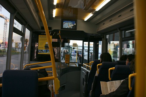
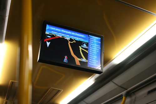
The GPS navigation system in the bus that goes from Lisbon airport to the city center is an interesting device. Located in the front and at the middle of the bus, it allows customers to see where they are on a very basic map of the surroundings (a classical GPS map actually) along with a list of stops.
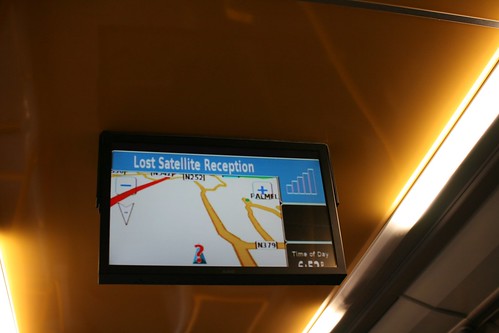
Of course, the most intriguing case occurs when the GPS signal is lost because 1) the street is too narrow (canyon effect), 2) the bus was under a piece of architecture that prevent the capture of GPS signal ("Lost satellite reception" as the error message says).
Why do I blog this? observing various use of location-based services when visiting new places. What is interesting here IMO:
- The shallow interface of this GPS display. The map itself is highly limited as shown by the crude representation of blocks. So far, the information printed there (apart from the list of bus stops) is mostly targeted at a driver (who would need to look for information about the street he/she has to take) and not at the passengers.
- For "users" there is the possibilities of a collective practice around the maps. There should be some intriguing field studies to be conducted around this artifact, especially to understand people discussions (tourists/locals, people knowledgeable/not with this technology).
This example draws the question of how to design a GPS-enabled navigation device for bus passengers that would offer a meaningful interface for different target groups (likely to be in this bus that goes to the airport). That said, I believe in the potential of such devices, there could be interesting services developed for single-users and groups