Urban

"The tube map as a graphical user interface to the city"

Read in "Mind the Gap: The London Underground Map and Users’ Representations of Urban Space" by Janet Vertesi (Social Studies of Science 38, 2008). Hacker Mullins Prize, American Sociological Association: Science, Knowledge and Technology Section, 2006.):

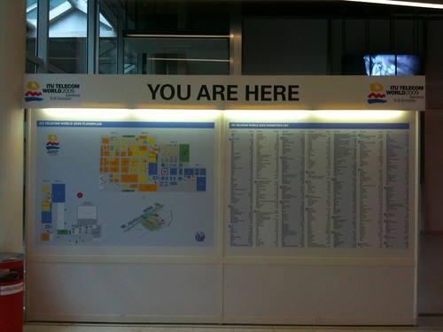
"A stable, iconic representation such as the Tube Map may convey a general sense of structure, establish points of interaction, and enable further representations and narratives about the object. It can act as a reference point for practices of navigation and wayfinding, affording judgments of normalcy and degrees of expertise or resistance. It may also, through its mapping of topological connections, be read not only as a subway map but as a useful way of representing the city in general: an object it does not pretend to represent. The Tube Map thus becomes something of a graphical user interface to the city, presenting and concealing opportunities for engagement, and making sense of the city to its users. (...) we are challenged to examine the representation as distinct from a discussion of ontology, topology, utility, or mimetic fidelity – against which the Tube Map would surely fail as an ‘accurate’ representation of London above-ground – to analyze the concrete ways in which representational organization enables narratives of movement and manipulation and, most important, to locate the boundaries and points of interaction for particular communities of users."

Why do I blog this? I simply loved this excerpt when reading the paper, wondering about its implications in map design. Regardless of the media employed (physical versus digital), there are some important decisions to be taken when designing such maps and the paper pinpoints relevant issues regarding this topic.

Besides, the quote "The tube map as a graphical user interface to the city" could also be interesting for class discussion about technical objects acting as metaphors.

Sidewalk expansion

Sidewalk expansion An interesting depiction of a recent phenomenon: the expansion of sidewalk in occidental cities. In this example, it used to be very tiny and the new version will make it wider.

The design of the urban environment is strongly modified according to recent concerns about global warming (less room for cars, more for bikes and pedestrians) and social trends (encourage physical exercise).

Lift seminar @ lift offices

Lift seminar Last monday, at the Lift seminar at our offices, we organized a set of talks about urban informatics. We discussed the large variety of data that are generated on top of the physical environment and their opportunities in terms of representations, analyses and services. When it comes to digital data, one can talk about "traces" but I will left the term "urban traces" out of the discussion because this discussion can applied to situations that go beyond the city context (suburbs, countryside...). This event was part of the urban informatics workshop series Fabien and have been running.

Quantification device (Fixed sensor to measure bike usage in Marseilles)

My introduction to the seminar was about the types data that are available. I presented first the usual kind of data (cadastral, road/railroads/water/electricity/cable/telephone networks infrastructures and usage), talked about the open data initiative. However, our interest was really about "traces" of people's activity in space, for which one can discriminate:

  1. Activity-generated data: fixed sensors that can detect bike usage, moving sensors (pedometers, mobile phone, use of Velo'v bikes (unlike Velib bikes, Velo'v seemed to have GPS sensors, is that correct?), automatic location-declaration (on location-based services such as Aka Aki which automatically tells you who is in the vicinity)
  2. Volunteer-based data: that is... user-generated content, which can be technology-based (pictures uploaded on sharing platforms such as Flickr, or self-declared positioning as people report their location on Foursquare). It can also be non-technology-based: see for example Respiralyon a french initiative that enable people to report on smells and odors in their own city.

Then Fabien described different projects he carried out, which aims at engaging the audience on the potentials benefits of exploiting the logs of digital activities in our contemporary cities.

(Measuring the pedestrian flows in Barcelona using Bluetooth sensors, a project carried out by Fabien for a spanish client)

To put it shortly, all of these data form a sort of informational membrane that surrounds the spatial environment. We have already dealt here with the possibilities afforded by these data that I described my french book about locative media:

  • Visualize the data to describe the urban activity, reveal the invisible, make explicit the implicit (you can see Real Time Rome as a paragon for this use). This first step generally helps bringing new perspective for decision making and policies building or raising awareness and effect the discussion making of individuals or of a crowd.
  • Use the data as a model for spatial activities that can enable what i would call "urban stakeholders" to act upon them. A good example for this is to provide urban planners, transportation authorities or traffic engineers with data to refine their models of citizens spatio-temporal behaviors... and eventually help the decision-making process: where to install certain services (or how can we craft certain incentives so that we make specific shops/services to be located in a designated areas). As Fabien mentioned, these data can help to complement existing models (it's not a substitution) drawn out of surveys or qualitative analyses.
  • Use the data as a model to build applications on top of them. This is what Citysense aims at: building a tool to help people taking certain spatial decisions based on others' behavior. It shows the overall activity level of the city and hostpots as well as also links to Yelp or Google to show what venues are operating at those places. In addition, combined with other sources of information (such as Yelp), it allows to filter out places in the vicinity.

This part was followed by a presentation by Boris Beaude (EPFL) who is an insightful geographer and a talk by Pascal Wattiaux who discussed the role of technologies in the production of the olympic games. My role as a moderator did not allow me to take notes but Fabien did. Both of them gave some perspective to the "urban informatics" trend by showing a large set of constraints (geographical issues, event-related problems, marketing troubles), critiques (data reductionism) and of course opportunities for the near future.

Thanks Fabien, Boris and Pascal for their participation!

Street participation

How does this affect you? Seen in London last week, a classical form of citizen participation in occidental cities. Why do I blog this? It's interestingly ubiquitous (at least in the Camden neighborhood I was in) and situated. I like the way it frames the question in context. However, although the question seems relevant, the vocabulary is highly administrative and not very people-centric.

Ben Cerveny at Urban Labs

My (messy) notes from Ben Cerveny's talk at Urban Labs which was organized by Citilab (Cornella, near Barcelona) SYMmetric

The talk was entitled "The city as a platform: computational systems for urban society" and the basic take-away was the proposition to see the city as an Operating System.

Ben is interested in how to make urban phenomena legible and feed them back into people's experience. Which is why he works with Stamen that he describes as a data viz agency. In other words, representations that make visible these invisible complexities to give people a tool to visualize them.

He recently started Vurb (a pun on "verb" and "urban") as a follow-up to his previous venture, the "Playground Foundation" in Amsterdam. In this previous project, he was interested in how to build an infrastructure in a city to allow a new sort of play... that take advantage of behavior patterns, computational resources, create new meaning of play and may have a transformational effect... turned today into VURB... which is interested in going beyond play.

He reminded us that the city is already shaped by information as shown by a picture of the first newspaper in amsterdam "amsterdamsche courant". BUT what is new: citizens are now information makers and the city is an aggregation of an enormous quantity of data (from plumbing infrastructures to digital photographies and GPS) that reflects the individual expressions of all the residents... and can be perceived now in its entirety.

What does this produce? while 20th century cities were consumables, 21th century cities will be collaboratively produced, no longer to-down but completely emergent... a bit like this evocative picture of the "New Babylon" by Constant Nieuwenhuys:

All of this lead to this idea of an operating systems for the built environment The various layers of the urban stack are differentially accessible to citizen input:

  • sensor networks: not so much
  • dynamic infrastructural services
  • collaborative modeling: everybody is expressing their aspiration for the city, this is captured in a software model that represents a parallel state: the "cloud city", a set of information that is dynamic, active and aggregated... almost the spirit of the city... the idea that all of the human information and the history of the city lives in a dataset that can be used in different circumstances

We can then have a real-time model of urban scale space: it reflects a politics of a situation, a model does not reflect the entire reality. What type of model do we want to represent the city? Ben claims that we don't want one, we want a thousands! like web-services... there are going ways to bring models on space. The other side of the model is who is in the model, who takes advantage of the model: social networks are the inhabitants, which leads to massively multi-participant models... like an offline game.

Ben drew a parallel between urban planning and game design... the "secret school of learning interaction design" (as it teaches to design for users who do not read manuals, teaches how to make people learn new things progressively... or WoW status aggregation is twitter avant la lettre)

Another thing that I found interesting in his talk was this comment about Barcelona:

"I'm interested in looking at barcelona on the Google maps... look at how the barrio gotico is messy and then you see the grid... look at the boundaries... they look as if you could move a slider to accelerate the transition between the messy old city and the grid"

City center

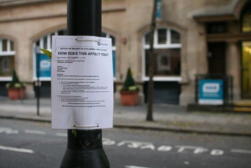
I've always been curious about the location where people (citizens or visitors) place the center of a city. You can define it as an area but also at specific points.
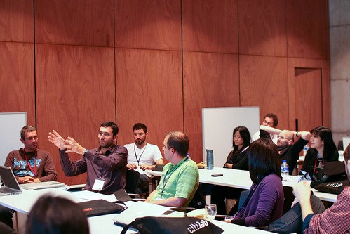
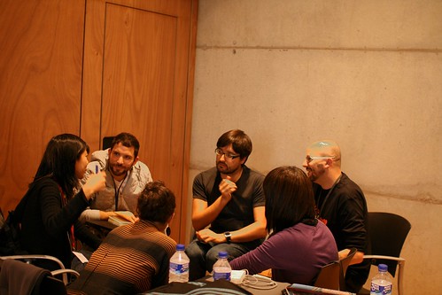
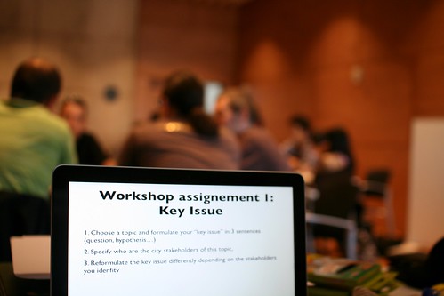
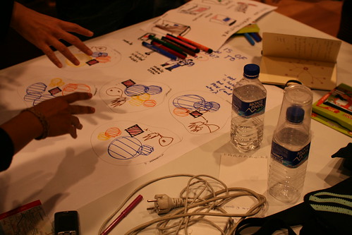
You have different ways to explore this question:

  • Asking people what is the point they would refer to as the center of a city. This kind of enquiry is common in environmental psychology and may help to uncover how individuals have specific representations (psychologists would call them mental models). Depending on the sampling (visitors/tourists, job type...) the answer may be different: should it be the CBD? the geometrical center? Should it be the Schelling Point?
  • Observing how city centers are represented in technological artifacts such as maps or guidebooks. For example, looking for cities in digital mapping systems such as Google Maps and observe where they put the red dots that correspond to the city. In this case, it will reflects a specific norm chosen by the Googleplex engineers. I'd be curious to know the underlying rationale behind this positioning.
  • ...

Why do I blog this? thinking about urban notions and their representations. I find intriguing to define what is a city center and how human beings think about this concept.

A synchronicity: Design Fictions for Asynchronous Urban Computing

New dispatch: "A synchronicity: Design Fictions for Asynchronous Urban Computing" by Julian Bleecker and myself has just been released. It's a discussion between the two us from the Situated Technologies Pamphlets series, published by the Architectural League. This series aims at exploring the implications of ubiquitous computing for architecture and urbanism: How are our experience of the city and the choices we make in it affected by mobile communications, pervasive media, ambient informatics and other “situated” technologies? How will the ability to design increasingly responsive environments alter the way architects conceive of space? What do architects need to know about urban computing and what do technologists need to know about cities?

Introduced by the editor as:

"In the last five years, the urban computing field has featured an impressive emphasis on the so-called “real-time, database-enabled city” with its synchronized Internet of Things. In Situated Technologies Pamphlets 5, Julian Bleecker and Nicolas Nova argue to invert this common perspective and speculate on the existence of an “asynchronous city.” Through a discussion of objects that blog, they forecast situated technologies based on weak signals that show the importance of time on human practices. They imagine the emergence of truly social technologies that through thoughtful provocation can invert and disrupt common perspective."

We'd like to thank Omar Khan, Trebor Scholz and Mark Shepard for this great opportunity!

Lift @ Citilab in Barcelona

Last saturday at Citilab in Cornella, near Barcelona, Fabien and myself organized a "lift @ home" event. A one-day long workshop, this event was called "Hands on Barcelona's Informational Membrane. It was part of a series of seminar about the new practices as well as the visions and issues around the hybridization of the digital and the physical in cities. We focused on the informational membrane hovering over Barcelona and try to sketch near-future scenarios with datasets and infrastructures existing in city. The goal was to understand a contemporary urban software infrastructures and explore the implications (trade-offs, opportunities and concerns) in the data they generate. The effort was put on Barcelona’s specific issues (e.g. mobility, infrastructure, tourism, gentrification, ecology …) and their related datasets.

lift @ citilab

We had a group of 30 participants coming from very diverse backgrounds: designers, engineers, people from the city of Barcelona, ethnographers, architects, etc. both from the area and abroad. We started from a presentation&discussion about the general problems of Barcelona and the available data. Then small groups have been formed to work on how to use the existing infrastructures and data to create potential solutions in terms of services. The assignments led people to go beyond traditional techno-determinism to envision social and organizational framing.

lift @ citilab

lift @ citilab

lift @ citilab

We're working on a short write-up document for this workshop. Something that would summarize the findings and pave the way for upcoming seminars.

Digital traces and tourism

Yesterday in Sierre, I gave a talk about the use and implications of digital traces for tourism services. Slides are on Slideshare. [slideshare id=2312286&doc=etourismforum2009nova-091021135319-phpapp02]

The point of the talk was the following: we're seeing the advent of location-based services and augmented reality applications. But those are only the "interface" aspect of a broader phenomena: the aggregation and use of digital data to create new sorts of services. Indeed digital objects used by people such as mobile phones and cameras leave a large amount of traces: the phone can be geolocated through cell-phone antennas or GPS and digital cameras take pictures that people can upload on web sharing platforms such as Flickr. All of this enable new application that allow to count tourists or provide them with new sorts of services. Based on existing experiments, the presentation addressed how the tourism industry can benefit from these digital traces to obtain new representations of tourists activities and to build up new services based on them.

Thanks Roland Schegg for the invitation.

@ and interweb idioms

Web n' c@ll My fascination towards the use of web-related symbols always leads me to spot occurrences such as the one shown here. Seen in Lyon this week, the pictures depicts the use of the at sign in two interesting configurations.

Mobile web!

If we look carefully at the idioms that are created here, we notice a naive-but-interesting mixture of the interweb meme.

"Web n'c@ll" is quite intriguing as it reveals that this shop provide its customers with a web access and the possibility to make phone calls abroad. The presence of the "at" in the "call" word is curious because it does not really mean something (I take the "at" as the symbol for emails, so it's hard to call using the email protocol). it must definitely be a trick to make the "web n'c@ll" brand much more hip (!).

The second picture tells us a different story. I love this sign although nervous graphic designer will find it ugly. IMO, it represents the hybridization of mobile phone communication and the interwebs. The shop actually sells cell-phones, among which one can buy smart phones that allow a connection to the internet. It's interesting to notice how this symbol is used for representing the possibility to access the information super-highway.

Why do I blog this? observing traces of interweb culture in everyday objects. Now that the terms "web" or the "@" sign is much more common, it's curious to see how they're employed here and there to communicate various meanings. I take it as an example of the meme circulation in the public sphere.

That said, it seems that the sign is not very common yet, as shown by the picture below, taken in the same street, with a weird capital "a" in the "at sign":

Capital @

Adaptive street infrastructures

Adaptive water interface Several occurrences of adaptive street interface encountered in Geneva this summer. The street fountains has been accommodated with either a little table (above) or both a little table and a bench (below) with a bright orange color. I assume it's meant to encourage the street life/gathering around fountains.

Add-on

Another example below: a street garden device made out of wood

Guerilly gardening

Why do I blog this? interest towards how the existing (hard) infrastructure can be complemented by other add-on devices that can enable new behavior (gardening) or facilitate existing ones (gathering). It's interesting to think about how to start from existing elements and not go directly for a new artifact.

Besides, I also like the temporarily aspect of it: the orange steel devices seem to be limited for summer use. Different seasons, different objects.

Upcoming piece about the asynchronous city

Julian Bleecker and myself are putting a final touch to a pamphlet entitled "A synchronicity: design fictions for asynchronous urban computing" in the Situated Technologies series. Here's the blurb:

"Over the last five years the urban computing field has increasingly emphasized a so-called “real-time, database-enabled city.” Geospatial tracking, location-based services, and visualizations of urban activity tend to focus on the present and the ephemeral. There seems to be a conspicuous “arms” race towards more instantaneity and more temporal proximity between events, people, and places. In Situated Technologies Pamphlets 5, Julian Bleecker and Nicolas Nova invert this common perspective on data-enabled experiences and speculate on the existence of an “asynchronous” city, a place where the database, the wireless signal, the rfid tag, and the geospatial datum are not necessarily the guiding principles of the urban computing dream."

Due for September 2009. A sort of updated version of near future laboratory thinking that builds upon various projects, discussions (and partly going beyond material from my french book). Stay tuned.

Telescope to see leaves

Installation in Lausanne This huge tube that looks like a medieval bull horn is one of the installation from the Lausanne Jardins project (Lausanne garden), which is a series of devices located here and there in the city that aims at renewing the relationship to nature.

The piece above is called "Dentelles" ('lace' in english) and it has been designed by Aline Juon, Florine Wescher. It's made of 3 telescopes that target a nearby forest (yes, in Lausanne) which used to be much closer to the city in the past. These devices have been created as a invitation for passers-by to observe the detailed elements of trees, and eventually notice this fragile urbanization boundary as a "lace".

Why do I blog this? the gigantic size of the devices struck me as fascinating when I came past. Observing the trees through the lense is intriguing as it leads to a very detailed representation of leaves, as if you were close to nature (like it used to be in the past in this neighborhood). Unlike lots of devices which are meant to make visible phenomena that are invisible, this piece aims at bringing things closer, which is also an interesting goal.

It looks like a sort of macroscope (big size of the device) but it's closer to a microscope.

Yet another weird toilet interface

Toilet door interface(Out)

Toilet door interface (In)

This toilet door encountered in a french train yesterday struck me as fascinating. On both side of the door (in and out the toilet), you have a remnant of the past (a door handle that has its highly efficient affordance) and a set of button (open/close). As you can imagine, most the passers-by start by turning the door handle, which fails to open the door, they then froze and realize they can press a button. The next step is that they come in and realize that a similar masquerade happens inside. What is intriguing is that when outside of the toilet, the button set is close to the door handle, which is not the case inside (hence the presence of weird yellow arrow-shaped stickers).

What happened here? The combination of two interaction styles (buttons + door handle) is stunning and detrimental to this basic interaction (opening and closing a door uh!). What's the design rational here? maybe that it's less physically demanding to press a button and wait that the door automatically closes/opens. However, and you may expect, people IN the toilet are generally anxious about how to close this god damn door. Some even try to grasp and push the handle, which does not allow to lock the door.

Let's have a look closer:

Toilet door interface

Besides, the button set is perhaps not the best way to interact but the presence of both is even more confusing. Weird arrows, red circles for emergency opening, what a mess!

Why do I blog this? observing how everyday basic interactions can be transformed into complex encounters with objects. And yes, I always bring my camera when I go to ANY toilets, it's an interesting place to analyze weird technological innovations.

Robust computing

Touch interface A street interface seen in Marseilles, France the other day. Located in a very crowded and touristic area, and aimed at informing visitors, the specification that lead to this device certainly put a super strong emphasis on the firm and protected quality of the material. What is even more intriguing is the verticality of the keyboard with extra-large touch-keys.

In an era where public things are punched and molested, new design constraints call for new solutions. And it's often robustness that is perceived as the main possibility. See also the following example with the metal keyboard found at UBS in Switzerland:

coredumped

Why do I blog this? observing current design constraints and solutions people have put in place, wondering about how, down the road, people use the vertical keyboard up there. The UBS bank machine is maybe slightly more usable though. Isn't there a trade-off between the robustness of the device and its potential usability?