Locative Media

Location-awareness sharing and affordances in the subway

Two recent articles about location-based platforms caught my eyes Seeburger, J., & Schroeter, R. (2009, Nov 23-27). Disposable Maps: Ad hoc Location Sharing. In J. Kjeldskov, J. Paay & S. Viller (Eds.), Proceedings OZCHI 2009 (pp. 377-380). Melbourne, VIC: The University of Melbourne.

"The gathering of people in everyday life is intertwined with travelling to negotiated locations. As a result, mobile phones are often used to rearrange meetings when one or more participants are late or cannot make it on time. Our research is based on the hypothesis that the provision of location data can enhance the experience of people who are meeting each other in different locations. This paper presents work-in-progress on a novel approach to share one’s location data in real-time which is visualised on a web-based map in a privacy conscious way. Disposable Maps allows users to select contacts from their phone’s address book who then receive up-to-date location data. The utilisation of peer-to-peer notifications and the application of unique URLs for location storage and presentation enable location sharing whilst ensuring users’ location privacy. In contrast to other location sharing services like Google Latitude, Disposable Maps enables ad hoc location sharing to actively selected location receivers for a fixed period of time in a specific given situation. We present first insights from an initial application user test and show future work on the approach of disposable information allocation."

(Thanks Antonio!)

Belloni, Nicolas and Holmquist, Lars Erik and Tholander, Jakob (2009)See you on the subway: exploring mobile social software. In: In Proceedings of the 27th international Conference Extended Abstracts on Human Factors in Computing Systems, 4-9 April 2009, Boston, USA.

"This project explores the social possibilities of mobile technology in transitional spaces such as public transport. Based on a cultural probes study of Stockholm subway commuters, we designed a location- based friend finder that displays only people in the same train as the user. (...) The interviews showed that the users did not always have an obvious idea for what actions to take once they realized that a friend was on the same train (...) This points to the complexity a social situation like this and the multitude of social layers that comes into play for designers of social services. In this case, it seems like the user didn‟t feel close enough to his work colleague for taking contact at this particular moment. (...) Adding the possibility to call the person or send a text message could be one of functionalities improving the user experience."

Why do I blog this? Collecting material for current projects about location-based services. Both papers describe relevant studies about the user experience of location-awareness and the complexity of building social applications on top of it.

Manual check-in versus automatic positioning

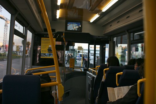
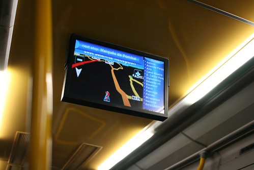
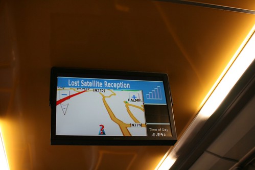
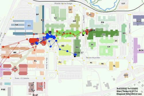
The picture above shows the difference between asking where someone is with an SMS and getting this information automatically with a location-based software such as Aka-Aki. This was a big debate few years ago. A more recent debate concerns the manual check-in versus automatic positioning with mobile social software.

The whole argument about manual check-in on platforms such as Foursquare versus automatic positioning (on Google latitude for instance) is fascinating to me. While some pundits criticize the idea of letting people manually check-in, various empirical studies shows why automation can be problematic. It's crazy how some people get grumpy and think that self-declarating one's location is old-school and passé. Some examples below of academic work about this issue. Of course it's not directly about current applications such as Foursquare, Gowalla, Loopt or Latitude but it certainly gives some perspective.

Vihavainen, S., Oulasvirta, A., Sarvas, R. "I Can’t Lie Anymore” - The Implications of Location Automation for Mobile Social Applications. Proceedings of MobiQuitous 2009, IEEE Press.

The paper examines a sample of users of Jaiku, a social networking, micro-blogging and lifestreaming service bought by Google three years ago. Using this platform, the researchers investigated the appropriation of this service that automates disclosure and diffusion of location information. Here are some excerpts I found relevant in Vihavainen's paper:

"Human factors research has shown that automation is a mixed blessing. It changes the role of the human in the loop with effects on understanding, errors, control, skill, vigilance, and ultimately trust and usefulness. We raise the issue that many current mobile applications involve mechanisms that surreptitiously collect and propagate location information among users and we provide results from the first systematic real world study of the matter. (...) The results reveal both “classic” human factors problems with the automation’s logic and novel issues related to the fact that location automation at times compromised their control of social situations. (...) The results convey that unsuitable automated features can preclude use in a group. While one group found automated features useful, and another was indifferent toward it, the third group stopped using the application almost entirely. (...) These differences highlight the importance of needs, activities, and structures of the intended user groups as factors for acceptance of automation."

Co-presence

S. Benford, W. Seagar, M. Flintham, R. Anastasi, D. Rowland, J. Humble, D. Stanton, J. Bowers, N. Tandavanitj, M. Adams, J.R. Farr, A. Oldroyd, and J. Sutton. “The error of our ways: The experience of self- reported position in a location-based game”. In Proceedings of the 6th International Conference on Ubiquitous Computing. (UbiComp 2004), Nottingham., pp. 70-87,

In this paper that is a bit older, the researchers studied how users of a collaborative location-based game employed self-reported positioning by manually reveal their positions to remote players by manipulating electronic maps. Results were the following:

" It appears that remote participants are largely un- troubled by the relatively high positional error associated with self reports. Our analysis suggests that this may because mobile players declare themselves to be in plausible locations such as at common landmarks, ahead of themselves on their current trajectory (stating their intent) or behind themselves (confirming previously visited locations). These observations raise new requirements for the future development of automated positioning systems and also suggest that self- reported positioning may be a useful fallback when automated systems are un- available or too unreliable."

Nova, N., Girardin, F., Molinari, G. & Dillenbourg, P. (2006): The Underwhelming Effects of Automatic Location-Awareness on Collaboration in a Pervasive Game, International Conference on the Design of Cooperative Systems (May 9-12, 2006, Carry-le-Rouet, Provence, France).

Finally, this is also an issue I addressed in my Phd research concerning the automation of location-awareness, I also address these problems with a different angle. We also used a collaboration location-based game (a quite common platform for running field studies at the time) and uncovered that automating a process such as location-awareness is not always fruitful. Letting people send their own position appears to be more efficient than broadcasting mere location information:

"To some extent, not giving location-awareness information can be a way to support collaboration more effectively; since players may communicate more and better explain their activity and intents. Self- disclosure can hence be more effective since users could express both information about their intents relevant for the task context and their location. They could also send it whenever they want to express either their current or past positions or the intended places they are heading to. Another interesting benefit of letting the users express their position is to give them the control of privacy issues, one of the major issue related to LBS usage. They have indeed the choice to disclose information about their whereabouts, which is of tremendous importance to avoid the users’ perception of privacy invasion."

Mobile social software norms

An interesting news on the Foursquare newsblog is about the "cheater code", i.e. a way to catch users who check in from their couches to steal mayorships. Interestingly, it seemed to be one of the most requested feature by people. Of course, it's not that easy to implement and the solution that has been chosen... lies in using the phone’s GPS (or another way to get the user's location) "to try to verify this". What I find interesting here is that the ambition is deliberately low (hence the "try"). The reasons why they do so are simply that it's hard:

" We are seeing some issues where people should be getting points / badges / mayors but they’re not. This could be because the GPS location your phone gave us was slightly off or because the address / pushpin where we located the venue wasn’t quite right."

Another valuable bit reveals a lot about the usage/norms about what is considered acceptable:

"Also worth noting that we’re fine with pre-checkins and post-checkins… you know, the checkins you send *before* you’re at a place (“I’ll be there in 10 mins!”) and the checkins you send us *after* you leave when you realize you forgot to check-in while you were there. (Trust us, we do it too to fill out our history pages!) The only difference now is that to unlock foursquare rewards - mayors, points, badges, etc - those checkins needs to be sent from that place."

Why do I blog this? I am fascinated by this kind of elicitation as it uncovers norms and behavioral issues that people put in place when using location-based services. Preparing a field study about the usage of this platform, I find interesting to take this into account.

"you are here" updates

Recent encounters in London with other "you are here" signs". The first one is interesting because it also add a "walking time" limit through a circle: You are here

This other one is a bit old and intriguing as it does not use a textual "you are here" but replace it with an elegant pointing finger: You are here

Why do I blog this? i simply continue the systematic list of "you are here" elements that i encounter. Can be handy when working on location-based services interfaces as examples of current practices.

mapenvelop: post it from the exact place

mapenvelop is a project by beste miray dogan that I like a lot: the inner walls of the envelope are blanketed by a Google map that indicates where the sender's address is. As described by the designer "post it from the exact place".

Why do I blog this an interesting low-tech approach to adding locational information to a message. A sort of locational information that adds subtlety in communication given that a map can be perceived as "richer" than a written address. It would be even more intriguing to have such envelopes for places you visit... you would buy a map of barcelona and pinpoint where you wrote the letter... so that your contact can be aware of where you thought about them. Surely something that is possible with digital communication through location-aware devices but that is even more curious on paper.

Co-presence in the 21st century

Co-presence Two persons in the same place, as represented on the Foursquare interface. A depiction of co-presence mediated by technology.

Co-presence, as described by Zhao can refer to the sense of being together with other people in a remote or a shared virtual environment. To refer back to Goffman, it's a form of human co-location in which individuals become "accessible, available, and subject to one another".

The advent of location-based services lead to a new class of situation where people can b both physically copresent (what Zhao calls "Corporeal Copresence") and located in electronic proximity (what Zhao calls "Corporeal Telecopresence"). Which is what happens with the Foursquare interface. The categories are then not mutually exclusive.

Why do I blog this? curiosity about what this kind of constraints can lead to, in terms of location-based services in a physically co-present context.

Earth Sandwich

Making an "Earth sandwich" is a curious practice found in Generation A by Douglas Coupland which was originally proposed by Ze Frank:

"I’d taken a slice of boring white bread from its bakery bag and had slapped it onto a small patch of yellow sandy dirt. I was standing up to photograph the slice of bread using my mobile phone. Why would you have been doing this? I hear you wonder. Excellent question. I was making an “Earth sandwich.” What is an Earth sandwich? Fair enough. It’s when you use online maps to locate the exact opposite place on the planet from you, and then hook up with someone close to that place. Then, after you mathematically figure out exact opposite GPS coordinates to within a thumbnail’s radius, you put a slice of bread on that spot, then connect via cellphone and simultaneously snap photos: two slices of bread with a planet between them. It’s an Internet thing. You make the sandwich, you post it, and maybe someone somewhere will see it, and once they’ve seen it, you’ve created art. Bingo.

Why do I blog this? this sort of ludic practice automatically found its way to my list of locative-technologies-repurposed-for-other-aims. Perhaps some sort of new and extreme ritual from the 21st Century (definitely the kind of ideas that Coupland document/describe/invent). Let's wait for the iPhone app, I am pretty sure someone out there would be willing to develop it.

Such idea sounds weird but I am convinced there would be some curious possibilities in interaction design, a sort of long-distance location-awareness if you want. Much of the focus in human-computer interaction research and product development revolves around the notion that location-awareness makes sense at the urban level (or national). The granularity is generally low, A gets a message that B is nearby (neighborhood/in town) and acts accordingly.

However, the Earth sandwich practice/meme is interesting from the long-distance viewpoint. Are there situations (casual or professional) where it's pertinent to know where others are? Should the granularity be different than current mobile social software? I guess so although I don't really know a precise use case. Maybe diaspora and families spread across the globe may be curious about it.

New chapter about design issues in location-based games

" Digital Cityscapes: Merging Digital and Urban Playspaces " a book edited by Adriana de Souza e Silva and Daniel Sutko that deal with location-based games and urban informatics:

"The convergence of smartphones, GPS, the Internet, and social networks has given rise to a playful, educational, and social media known as location-based and hybrid reality games. The essays in this book investigate this new phenomenon and provide a broad overview of the emerging field of location-aware mobile games, highlighting critical, social scientific, and design approaches to these types of games, and drawing attention to the social and cultural implications of mobile technologies in contemporary society. With a comprehensive approach that includes theory, design, and education, this edited volume is one of the first scholarly works to engage the emerging area of multi-user location-based mobile games and hybrid reality games."

The book features a chapter called "Framing the Issues for the Design of Location-Based Games " written by Fabien and myself (at the time I was still at the Media and Design Lab at EPFL). It basically describes an overview of the three main design issues we tackled in CatchBob!: the role played by physical features (physical world structure, staircases, etc), the importance of the technological infrastructure (namely, WiFi) and finally the user experience of mutual location-awareness.

Why do I blog this? this is the final paper about the CatchBob! project which occupied Fabien and I from 2004. A big part of the project was about the socio-cognitive influence of mutual location-awareness (which has been done when we were at CRAFT but the one described in this chapter has benefited from my stay at the Media and Design Lab. The discussion we had at the time (2007-2008) were more geared towards architecture and design and certainly shaped some ideas that we discuss.

On a different note, although the chapter and the book are about games, there is a lot to draw out of this specific domain. Urban informatics as a whole could benefit from the elements discussed there.

Upcoming piece about the asynchronous city

Julian Bleecker and myself are putting a final touch to a pamphlet entitled "A synchronicity: design fictions for asynchronous urban computing" in the Situated Technologies series. Here's the blurb:

"Over the last five years the urban computing field has increasingly emphasized a so-called “real-time, database-enabled city.” Geospatial tracking, location-based services, and visualizations of urban activity tend to focus on the present and the ephemeral. There seems to be a conspicuous “arms” race towards more instantaneity and more temporal proximity between events, people, and places. In Situated Technologies Pamphlets 5, Julian Bleecker and Nicolas Nova invert this common perspective on data-enabled experiences and speculate on the existence of an “asynchronous” city, a place where the database, the wireless signal, the rfid tag, and the geospatial datum are not necessarily the guiding principles of the urban computing dream."

Due for September 2009. A sort of updated version of near future laboratory thinking that builds upon various projects, discussions (and partly going beyond material from my french book). Stay tuned.

Granularity degrees of "nearby"

Easyjet recommandation Travelling very often in different european cities, I am always curious about Easyjet place recommendation to observe what sort of advices they bring to the table and how they renew their propositions over time.

Easyjet recommandation

One of the feature that interest me is the "Escape" part, the quick description of how to go out of the city you just landed and what sort of magical things you can discover in the surroundings. I generally look at various cities (Paris, Lyon, Geneva, Lisbon, Milan, etc.) and am sometimes struck by the granularity of the "escape" range. Sometimes, most of the time I should say, the recommendation is to visit something nearby. The term "nearby" or "vicinity" is not stated, yet it's the basic assumption of the "escape paragraph". Like you're in Paris and one recommend you a quick hop to Eurodisney, not my thing but it's fair enough, it's quite close in termes of mileage (kilometers for the metric readers).

However, there are sometimes exceptions. In the example shown form a recent Easyjet trip, the description of the city of Lyon is filled with "escape" notes about the possibility to visit Camargue. Surely a nice place that I explore from time to time, but definitely not perceived as "nearby" from the continental europe standpoint... given that you must at least drive 3 hours from Lyon to get there.

Why do I blog this? This is definitely no big deal but it strikes me as revealing to what extent representations of "nearby escape" can be perceived. There is clearly here a gap between the writer's mental model and reader's representations. Of course, there is not just one type of reader and it may matter to escape from Lyon and go to Camargue. What is at stake here, and it's a must-have question for location-based services designers, is the notion of spatial granularity which needs to be taken care of. Let me reformulate it here: if you want to provide people ("consumers") with location-based information about what is relevant in the vicinity, how can you make sure what is hidden behind the term "in the vicinity" or "nearby"?

Location-based audio file in Marseille

Tag for location-based information A subtle cue on the pavement that indicate that you should press "2" on the audio-guide. An interesting location-based service which do not necessitate a GPS or any other positioning technology. In this case, it relies on people's curiosity and will to spot this sort of red dot on the pavement.

Why do I blog this? apart from the general aesthetic of the cue, it's interesting to contrast this sort of approach and a positioning technique. What are the pluses and minuses? What are the conditions under which it would be better to let people spot such cues (and hence be more active)?

French book about locative media and LBS

Les Médias Géolocalisés My french book about locative media and location-based services (FYP Editions) has just been released. It's an overview of the field, that starts from the technical standpoint and go through various questions: what are they for, why the common scenarios (buddy-finder, spatial annotation, location-based coupons) have troubles being adopted, what to expect in the future as well as the space/time/social implications.

Les Médias Géolocalisés

Les Médias Géolocalisés

Update: my editor tells me that the rights to publish the books can be discussed with him (through contact (at) fypeditions (dot) com)

Pieces of personal informatics left on our office door

Printed dopplr sheets At the Lift offices, we now print (yes, on paper) different pieces of personal informatics such as our Dopplr sheets of trips. As we are often in and out our physical offices, collocated colleagues and friends who swing by can access this a sort location-awareness board that is both accessible on the web (if connected to us through Dopplr) and on our office door. Information about our perambulations when traveling to different locations for field trips, vacations, conference visits, client meetings and stuff are then made accessible through two modalities: being connected through the interwebs AND coming physically to our offices (in addition, it also necessitates to know where our offices are located, which is not obvious).

What's next? perhaps a colleague will start adding post-it notes or drawing graffitis on the paper sheets, that would be an interesting.

Why do I blog this? Quite rough and paper-based, this example makes me think about the ways one can rethink non-computer based practices by adding rationale coming from software/web services design. The unbook is another example of such idea as it corresponds to the idea of re-injecting ideas from the digital sphere (e.g. the release early/often trope, the community-based model). As a matter of fact, translating ideas from the digital to the physical is perhaps not always interesting as it may embeds logics and underlying hypotheses that can be irrelevant (I wouldn't be that interested in translating productivity software/widget out of my laptop) but there could be curious and original design endeavor.

Of course the example above is flawed given that the Dopplr webpage is not really meant to be printed on paper and stuck on a wall; it's definitely a trick but uh it can be a good start. And it leads me to think about what would be a good asynchronous and paper-based location-aware device? shareable with friends? with a certain level of errors about my future whereabouts?

Bus GPS

Bus GPS Bus GPS

The GPS navigation system in the bus that goes from Lisbon airport to the city center is an interesting device. Located in the front and at the middle of the bus, it allows customers to see where they are on a very basic map of the surroundings (a classical GPS map actually) along with a list of stops.

Of course, the most intriguing case occurs when the GPS signal is lost because 1) the street is too narrow (canyon effect), 2) the bus was under a piece of architecture that prevent the capture of GPS signal ("Lost satellite reception" as the error message says).

Bus GPS

Why do I blog this? observing various use of location-based services when visiting new places. What is interesting here IMO:

  • The shallow interface of this GPS display. The map itself is highly limited as shown by the crude representation of blocks. So far, the information printed there (apart from the list of bus stops) is mostly targeted at a driver (who would need to look for information about the street he/she has to take) and not at the passengers.
  • For "users" there is the possibilities of a collective practice around the maps. There should be some intriguing field studies to be conducted around this artifact, especially to understand people discussions (tourists/locals, people knowledgeable/not with this technology).

This example draws the question of how to design a GPS-enabled navigation device for bus passengers that would offer a meaningful interface for different target groups (likely to be in this bus that goes to the airport). That said, I believe in the potential of such devices, there could be interesting services developed for single-users and groups

Computerized dispatched

CABS computerized dispatched When "computerized dispatched" becomes a selling point for cab customers. See last week in San Francisco.

Do you really wanna know the underlying process that made this cab approaching you (phone calls, location-based services, etc.)? Or will you be more confident that this cab company is efficient because of the computerized dispatching? Or less confident?

Space-time trails and locative technologies

Trail on a location-based game(Pictures of space-time trails in CatchBob!, nothing really related to the paper below, just found it illustrative of this digital trail notion)

Perusing "Where Were We: Communities for Sharing Space-Time Trails" by Scott Counts and Marc Smith, I was interested by this notion of "space-time trails".

Constituted by the movement of people in space indeed forms an interesting social object. Space-time trails incorporate both a collection of spatial positions with relationships to one another along with sensor and community-based annotations (photographs, video, environmental sensor data, physiological attributes, community-based content such as tags and comments). According to the authors:

"We argue that space-time trails, or routes, include an intentionality on the part of the user that contains more information than a collection of points. A route has a start and finish, as well as properties like time, distance, speed, directional orientation, numbers of stops, and so on. When browsing, retracing, mining, recommending, and searching, these collective and relational attributes can be leveraged for a significantly richer end-user experience than could a collection of points. (...) The sum of these changes could be considered to be a kind of “pervasive inscription revolution”, an era in which practices of inscription explode to include almost all human actions and interactions. The signs of the expansion of inscription are visible in the behavior patterns seen in many online services."

Why do I blog this? interested in how "routes" and "trails" becomes social documents enriched with other forms of information (beyond synchronous/real-time location-awareness). Some interesting new practices can emerge out of this and lots of issues regarding privacy are about to be discussed.

About space and 'plek'

The distinction between "space" and "place" is commonly discussed in recent academic work in ubiquitous computing/HCI by researchers such as Paul Dourish. In a seminal paper form 1996, Harrison and Dourish express that "space is the opportunity; place is the understood reality." They raised the social construction of space by exploring how human actions are structured by the spatial organization of our environment. Unfortunately, as Dourish pointed out in his 2006 paper, this discussion lead to a misunderstanding: some people tended to exaggerate the distinction between spatial and social components. Interestingly enough, reading Assia Kraan's paper "To Act in Public through Geo-Annotation shared location", I ran across this interesting paragraph:

" It is important to make a distinction between space and plek. Anglo-Saxon theoreticians talk about space and place. The Dutch word plek (plural plekken) will be used here because the alternative ‘place’ does not express its meaning adequately. ‘Place’ is used, for instance, to refer to the physical space of a settlement, while plek refers to the meaning that a physical space has for somebody. A plek can be described as a complex ensemble of physical characteristics, cultural experiences, history and personal logic. Geographers target the navigational characteristics of plekken, but the computer scientists Paul Dourish and Steve Harrison emphasize an aesthetic quality. They recognize the function of plekken in a creative appropriation of the world and describe plekken as ‘developed sets of behaviour, rooted in our capacity to creatively appropriate aspects of the world, to organize them, and to use them for our own purposes’"

Why do I blog this? ruminating about different words and their cultural meaning is relevant here as it can express underlying dimensions.

Location-awareness and power management

The Potential for Location-Aware Power Management by Harle and Hopper is an interesting paper presented at Ubicomp 2002 that explore the use of location-awareness to dynamically optimise the energy consumption of an office. It basically shows how capturing workers' location can be helpful in a different domain than mobile social software or urban computing. Location-aware power management (Figure taken from the paper: positions recorded for a particular user over four hours on a particular day across three floors)

The paper does not really describe an application, instead it demonstrates how an analysis of workers' location is relevant "to form a picture of how people work and what energy savings might reasonably be expected if we were able to prevent device ‘idling’". The authors link the discussion about "energy sinks" and workers' movement: is it possible to lower the power consumption of electrical devices when the users are not using them... by detecting whether the user is within range.

Of course, apart from the technological side, the main issue at stake in this kind of research vector is the following:

"we emphasise that any changes should not frustrate users. As an example, we informally asked a number of computer users in various commercial and non-commercial settings why they did not have their desktop machines automatically power down, suspend-to-disk, or go to sleep after a specified time. The majority cited the frustration of having to wait for the system to reach a usable state as a major contributing factor. We cannot afford, then, to assume that an aggressive power saving policy will necessarily lead to power savings since it may prove very unpopular and be circumvented. Instead workstations in the scheme discussed must be powered up and in a usable state before the user is physically upon them. "

Why do I blog this? home/office automation is an favorite topic of mine as it uncovers important issues regarding the loss of control from users. Of course, I find the use of location-awareness relevant in this sort of context and I am wondering about other way to deploy this sort of solution without frustrating users. The paper offers a good discussion concerning such issues.

Mobile Monday Amsterdam

Directions Some random notes from Mobile Monday Amsterdam, where I was invited last monday (to give a talk about "what the hell happened to location-based games"). The event was more specifically about mobile gaming/entertainment:

  • Jeroen Ellferich interestingly brought this intriguing question: would you differentiate an iphone from an ipodtouch? is a Nintendo DS a mobile game platform? what about eee pc?
  • He also reported on the odd fact that the most downloaded games today are the same as 5 years ago: tetris, pacman, who want to be millionaire, monopoly here and now, bejeweled, showing how the field is not very innovative.
  • To him, the dark side of the mobile industry have the following characteristics: flattening growth traditional developers and publishers on mobile in troubles, fragmentation and porting hell (450 phone models!), flawed vale chain and low rev shares, lack of innovation in past years
  • BUT, he showed that there is some hope: iphone and android trigger mobile content revival, flat-free and connectivity become the norm, there is a business case for location-based games (!?), social networks and games are a "killer combo", touchscreen, tilt, compass are opportunities too
  • Kamar Shah, formerly at Nokia, described how users are far from the dream of having a simple mobile entertainment platform (as simple as we had on TV). He showed how people are tired because of fragmentation (operators, services, partners), experience is generally shit, it does not work, people pay twice... and unfortunately bad meme spread faster
  • Kamar also mentionned that people want to watch stuff, tv, high def, replicate their experience on the mobile: it's the platform and the content that will drive the revenue, not the hardware.
  • His main point was that the consumer experience is based on 5 key elements: how to find, try, buy, manage and share:
    1. we should make content accessible (over the air, on device, off the portal, on the portal...), consumer choose afterwards and have different habits: "content is king, distribution is king kong"
    2. people need to be able to try: demo, free-trial (website, on the phone), engage consumers otherwise the top 3 games will still be tetris and pacman!
    3. you have to enable all payment and billing mechanisms (micropayments...)
    4. when you buy food, you put it in the fridge, where do you put mobile games? there's a need of storage and manage in an easy place; apple does that really well: they have a marketplace where to go
    5. sharing content for free: it has to work, if you like sth, you'd like to pass it on, you should be able to send it via email, bluetooth...
  • Redefining the consumer experience implies taking care of these 5 issues.
  • He concluded that the financial crisis will have important consequences: people loose their job, can't pay the rent, how will they find the money to buy games? what's gonna happen? Kamar said that (1) people will have more time, (2) consumer demand will go down, people will learn what to do with what they have (the complexity of mobile phones), will educate themselves. It's good for our industry, because it's expensive for the industry to educate consumers. They will do it by themselves, (3) we will be able to take our technology right (and it takes time)

Thanks Yuri van Geest and Maarten Lens-FitzGerald for the invitation!

Awareness, visibility and Twitter

Looking at the webosphere, it's funny how certain topics appear to be new and shiny when they exist for quite a while. The notion of "ambient awareness" is one of these terms that you hear here and there as if it was brand new. It generally refers to the possibility to stay tuned with what your contacts/social network is doing, will do or think. A social radar of some sort, enabled by microblogging platforms such as Twitter or Jaiku (or Facebook status). What's intriguing is that the whole discourse about these services neglect the large array of research about "awareness". In the last twenty years, authors such as Paul Dourish, Saul Greenberg or Thomas Erickson have produced a lot of material, studies, guidelines, theories and recommendations about this. In this blogpost, I wanted to get back to this issue since it's important to describe what has been done in the past about it, before looking at the Twitter example. A brief recap of the research about Awareness

All started in a research domain called "Computer-Supported Collaborative Work", the branch of Human-Computer Interaction which looks as how technologies can support and enrich collaboration practices. Now this field is more and more concerned by other contexts than work (such as education or games) so we can perhaps use the term "social computing" to make it broader. The last twenty years of research in this field acknowledges the relationship between collaboration "efficiency" and the visibility of group members’ activities across time and space; namely enabling what has been called awareness by the research community (see for example Dourish and Bellotti, 1992, Dourish and Bly, 1992; Gutwin et al., 1995, Erickson and Kellogg, 2000).

Historically, the notion of awareness has been drawn from two domains. On one hand, it emerged from field studies of collaborative work in co-present work settings (Heath, & Luff, 1992; Heath and Hindmarsh, 2000), which focus on how workers systematically coordinate their activities by relying on changes in the local context as well as on their partners visible contributions. In this context, awareness is seen as the ‘mutual visibility’ of each other’s actions, conveyed by the continuous broadcast of information generated during the course of action. Of course, as Heath and Luff (1992) point out, this mutual visibility/observability of actions relies on the active practice of team members who make their own actions ‘visible/observable’ to the others. On the other hand, the notion of Awareness appeared in computer science, as a concept relevant to design collaborative technologies (Dourish and Belloti, 1992; Gutwin et al, 1995; Erickson and Kellogg 2000; Gutwin and Greenberg, 2002). As opposed to the richness of a copresent situation, geographically dispersed collaboration engages participants in joint activities with a low visibility of each partner’s contribution to the main goal of the group. This is why ‘awareness interfaces’ or ‘awareness tools’ have been designed to convey more visibility, showing group members representation and actions.

As stated by Schmidt (2002), the term awareness is highly equivocal in the sense that it is used in a lot of different ways and is often qualified by many adjectives like ‘general awareness’ (Gaver, 1991), ‘workspace awareness’ (Gutwin and Greenberg, 2002) or ‘informal’ or ‘passive’ awareness’ (Dourish and Belloti, 1992). Definitions indeed range from knowing who is present in the environment to the visibility of others’ actions (Heath and Luff, 1992). These limits, however, did not prevent the CSCW community from using the ‘awareness’ concept as the starting point for many original and innovative collaborative technologies. In this thesis, we will not enter into this debate about setting a proper definition but instead focus only on the awareness of people’s location in a shared environment, be it physical or virtual.

Even though awareness is a broad and blurry concept, in the epistemological sense, there are some recurrent definitions set by scholars. Among all the terms that are used in conjunction with this notion of awareness, the one that has received the most important attention is certainly the “workspace awareness” that Gutwin and Greenberg (2002) describe as “the up-to-the-moment understanding of another person’s interaction with the shared workspace” (Gutwin & Greenberg, 2002). More precisely, according to these authors, awareness refers to the perception of changes that occur in the shared environment. These authors also highlight that awareness is part of an activity, such as completing a task or working on something. The main objective of awareness is not only to perceive information but also to recognize the contextual elements required to carry out a joint activity. This is what Dourish and Belloti expresses by saying that awareness corresponds to: “an understanding of the activities of others, which provides a context for your own activity” (Dourish and Bly, 1992, p.107). These definitions emphasize the idea that awareness is meant to enrich the context of collaboration; they also implicitly state that maintaining awareness is not the purpose of an activity but instead a basis for completing the task.

Types of Awareness and usage

Starting from the previously described definitions of awareness, Gutwin and Greenberg (2002) differentiated the core components of awareness according to simple questions such as “Who, What Where, When”. According to these authors, awareness can be described in terms of the period of time it covers, conveying information about the present state of the environment (“synchronous awareness”) and or about past occurrences of events (“asynchronous awareness”), which corresponds to the “When” question.

So, to some extent:

  1. the "who" question corresponds to notification tools which enables to know who is contacted on your IM client.
  2. the "where" question corresponds to location-based services as they allow the user to be aware of his or her's contacts whereabouts.
  3. and so on.

Knowing what others are doing or where they are located can be useful for various reasons: simplification of communication, help people to coordinate, supports inferences regarding the partners’ intentions, know if a partner/colleague/friend needs help or just to get a vague feeling of presence (belonging to a community of friends, family...).

Awareness and Twitter

Time for more recent applications. In her paper called "The Translucence of Twitter" presented at EPIC 2008, Ingrid Erickson examines Twitter in conjunction with the aforementioned theories about awareness and visibility. The paper is a field study which examines the use of Twitter and conclude "there are certain obvious ways that Twitter showcases people’s thoughts and behaviors, but less obvious ways in which interlocutors signal their awareness of being noticed. ". The author compares the notion of Awareness as described in the work of Erickson and Kellogg (about "social translucence") and Twitter usage to show the discrepancies and alternate means of establishing awareness:

"Indirect Awareness: awareness can be evoked via Twitter, just not always in a direct manner. (...) Twitter here is a visible trigger for a host of possible awareness-oriented response mechanisms, from the completion of a work task to a physical meet up to a phone call. (...) receives a phone call because of a Twitter post he makes, this act raises his awareness that his messages are not falling on deaf ears. In turn, he is less inclined to falsify or make irresponsible posts in subsequent communications. (...) Awareness by Incident: Microblogging during a critical incident, such as inclement weather, appears to bring together individuals across community levels (i.e., perceived close and extended) out of a common need for timely information exchange. (...) Within this critical incident, Twitter became a real-time forum to make reports from respective outposts both to signal well being and to check in with others, despite varying levels of intimacy."

Why do I blog this? I am trying to sort out some ideas about microblogging platforms and theories about Awareness. Of course, one of the underlying theme I am interested in refer to mutual-location awareness and how tools such as Twitter and Jaiku engage people in new ways to discuss spatial issues.